Introduction
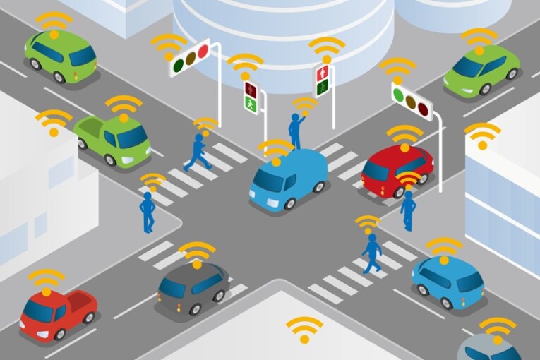
Intelligent transportation system (ITS) is the application of sensing, analysis, control and communications technologies to ground transportation in order to improve safety, mobility and efficiency. ITS includes a wide range of applications that process and share information to ease congestion, improve traffic management, minimize environmental impact and increase the benefits of transportation to commercial users and the public in general.
What are ITS?
Intelligent Transport Systems (ITS) involve the collection and processing of data:
- to provide information
- to advise or control the actions of
- travellers
- drivers
- fleet operators
- and network managers using computers with multi-media communications and other technology.
Wireless Communications
- Radio modem communication on UHF and VHF frequencies are widely used for short and long range communication within ITS.
- It offers communication between the vehicle and the roadside in specific locations applications such as Electronic Fee Collection (EFC) will operate over DSRC. It is a sub-set of the RFID- technology.
- Air interface Long and Medium range provides continuous communications between a vehicle and the roadside using a variety of communication media, including cellular and infra-red links.
Computational Technologies
- A typical vehicle in the early 2000s would have between 20 and 100 individual networked microcontroller/programmable logic controller modules with non-real-time operating systems.
- The current trend is toward fewer, more costly microprocessor modules with hardware memory management and Real-Time Operating System.
- Perhaps the most important of these for intelligent transportation systems is artificial intelligence.
Floating Car Data/Floating Cellular Data
- Floating Car or Probe data collection is a set of relatively low-cost methods for obtaining travel time and speed data for vehicles traveling along streets, highways, freeways, and other transportation routes.
- Floating car data technology provides advantages over other methods of traffic measurement:
- Less expensive than sensors or cameras.
- More coverage
- Faster to set up and less maintenance.
- Works in all weather conditions, including heavy rain.
Triangulation Method
- In the mid 2000s, attempts were made to use mobile phones as anonymous traffic probes. As a car moves, so does the signal of any mobile phones that are inside the vehicle. By measuring and analysing network data using triangulation, pattern matching or cell-sector statistics, the data was converted into traffic flow information.
- With more congestion, there are more cars, more phones, and thus, more probes. In metropolitan areas, the distance between antennas is shorter and in theory accuracy increases.
Vehicle Re-identification
- This method requires sets of detectors along the road. In this technique, a unique serial number for a device in the vehicle is detected at one location and then detected again further down the road. Travel time and speed are calculated by comparing the time at which a specific device is detected by pairs of sensors.
GPS Based Methods
- An increasing number of vehicles are equipped with in-vehicle GPS systems that have two-way communication with a traffic data provider. Position readings from these vehicles are used to compute vehicle speeds.
Sensing Technologies
- Technological advances in telecommunications and information technology, coupled with state-of-the-art microchip, RFID and inexpensive intelligent beacon sensing technologies, have enhanced the technical transportation systems globally.
- Sensing systems for ITS are vehicle-and infrastructure based networked systems. Infrastructure sensors are indestructible devices that are installed or embedded in the road or surrounding the road, as required, and may be manually disseminated during preventive road construction maintenance or by sensor injection machinery for rapid deployment.
Automatic Road Enforcement
- Speed Cameras that identify vehicles travelling over the legal speed limit. Many such devices use radar to detect a vehicle’s speed or electromagnetic loops buried in each lane of the road.
- Red Light Cameras that detect vehicles that cross a stop line or designated stopping place while a red traffic light is showing.
- Bus Lane Cameras that identify vehicles traveling in lanes reserved for buses. In some jurisdictions, bus lanes can also be used by taxis or vehicles engaged in car pooling.
- Level Crossing Cameras that identify vehicles crossing railways at grade illegally.
- Double White Line Cameras that identify vehicles crossing these lines.
- High-occupancy vehicle lane cameras for that identify vehicles violating HOV requirements.
Why Intelligent Transportation System needed?
- Inadequate road development.
- Low speed, increased accident rates.
- It is not possible to build enough new roads or to meet the demand.
- Make transportation system more efficient, secure, and safer through the use of information, communications and control technologies.
- Improve the attractiveness of public transport.
- Tackle rising congestion which increases travel times and industry costs.
- Reduce the environmental impacts of transport.
What Challenges Can ITS Address?
- Accessibility
- Environmental impact
- Urban regeneration
- UTMC systems
- Speed limit reinforcement
- Real time information
- Bus Priority systems
- Alternative vehicle routes
- Parking management
Conclusion
The ultimate benefits of a transformed transportation system—one that is fully connected; information-rich; and able to address safety, mobility, and environmental impacts—are wide-ranging and powerful. They will be felt by every one of us, delivering greater liveability to our communities and to our daily lives. ITS improves transportation safety and mobility and enhances American productivity through the integration of advanced communications technologies into the transportation infrastructure and in vehicles.


